QUICK TRAIL FACTS
- Preserve Size: N/A
- Trail Mileage: ~.7 miles one way
- Pets: yes
- Difficulty: short and steep
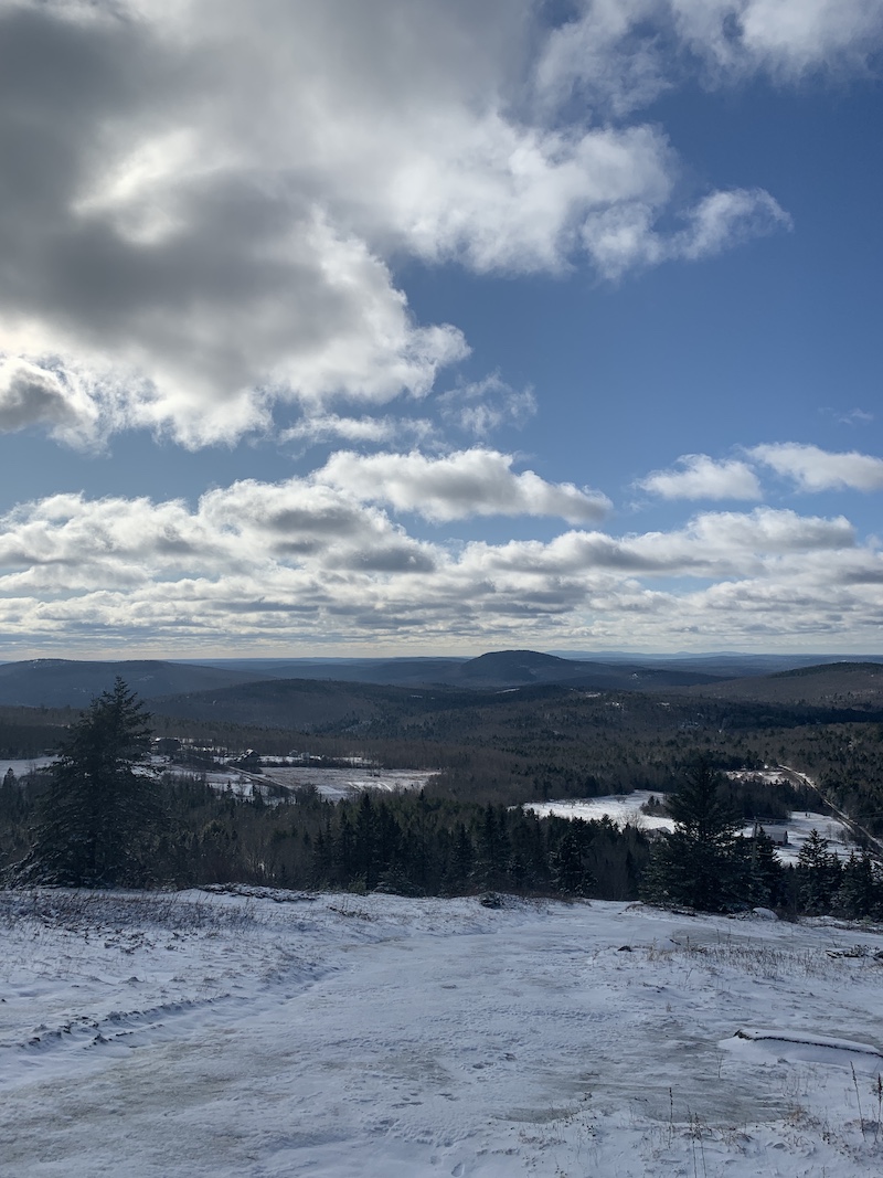
- Sights: views, open ledge, radio towers, remnants of the past
While the trail isn’t signed or blazed, it’s very easy to follow the trail to the top of the 1,260-foot mountain. Right from the trailhead, off Bald Mountain Road, you head up a wide access track. The road takes a turn to the left close to the bottom. If you doubt where to go, just head straight up! The elevation gain is about 450 feet.
I’m not sure if this main hiking track follows an old service road or an old ski run (this place used to be an alpine ski area, from the 1930s to late 1970s)—but it is very steep. You can also use the power lines as a guide; they end at a cluster of radio towers at the summit. I think the best views might be slightly to the right of and below the towers, where there is a big exposed ledge with lovely eastern views.
Because the trail is exposed and steep, on bare ledges, it can be very icy in the winter. Be respectful of the land and equipment here; it’s private property. I read online the mountain also holds the wreckage of a military jet that crashed in 1961.
Directions: From the Dedham Fire Department, take Bald Mountain Road about 3.7 miles to the trailhead on the left. A small area to pull over cars is just 100 feet or so beyond where Bald Mountain Road makes a sharp turn to the right. So the trailhead is technically on Johnson Road. Mind that you park well off the road so you don’t block traffic.