QUICK TRAIL FACTS
- Preserve Size: NA
- Trail Mileage: ~6 miles from end to end
- Pets: yes
- Difficulty: easy to moderate
- Sights: ravines, rocky bluffs, Casco Bay, Royal River estuary, mountain bikers
If you start at the trailhead on the Yarmouth’s West Side Trail that is close to the Route 295 (and the office building for Tyler Technologies) and walk east, toward the ocean, you can walk in one direction for about three miles before hitting Gilman Road and the bridge to Cousins Island. Then you can continue over the bridge all the way to the power station on the island, a little under two miles. This trail seemingly was designed with mountain bikers in mind, and some of the trails are winding and narrow. At steep hills, the trail has been cut into switchbacks. The path is well-marked with maps posted along the route.
The first part of the trail (near Tyler Technologies) begins at the large parking lot, and for the first 20-30 minutes you can hear the highway. But then it gets more quiet, and you wander along in the woods more or less parallel to the power lines (which you can also walk/ride along). There are occasional views of the sea as you walk toward the ocean. At times, the trail takes you under the electricity lines, but these portions are brief and the sunlight feels good. The trail connects with the Fels-Grove preserve. Beware of bike riders! Sometimes they come around corners quickly.
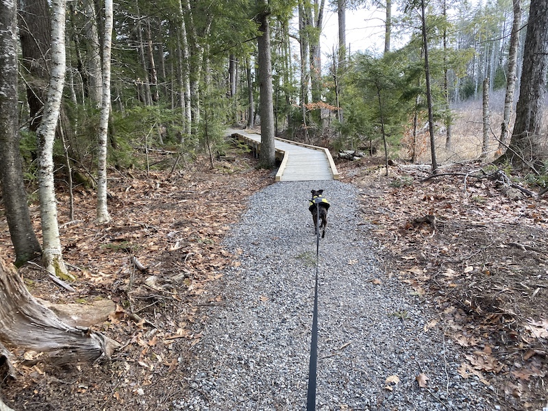
West Side Trail (western segments): Heading west from Route 295, leaving from the park-and-ride parking lot, there is a .2-mile section of the trail that is wheelchair accessible. It is wide and flat but not quite long enough (or nice enough) on its own to go out of your way for. Eventually, it will connect to the very nice wheelchair accessible trail farther along the power lines. This section of the trail, which is roughly 0.6 miles long, is perhaps one of the most pleasant I’ve ever seen in a power line corridor. The wide gravel path winds in and out of copses that dot the middle of the corridor. There are benches placed in shady corners. The trail system connects with some blazed neighborhood paths around Applecrest Drive and Hickory Lane.
Directions: Parking is available at the Fels-Groves Farm Preserve on Gilman Road and at the upper parking lot on Tyler Drive (formerly Cole Haan Driver) off Route 1, near Route 295’s exit 15. To access the wheelchair-accessible western segment of the trail, you can park at a satellite parking lot near Frank H. Harrison Middle School. It’s about 0.3 miles to the trailhead along a sidewalk on a fairly quiet road.