QUICK TRAIL FACTS
- Preserve Size: 130 acres
- Trail Mileage: 6 miles in network
- Pets: yes
- Difficulty: moderate to difficult
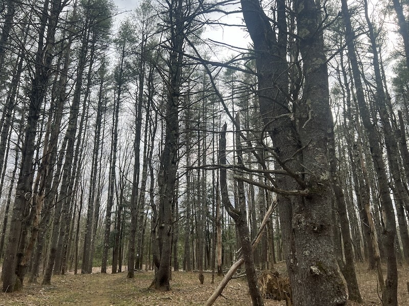
- Sights: Mill Brook, woods
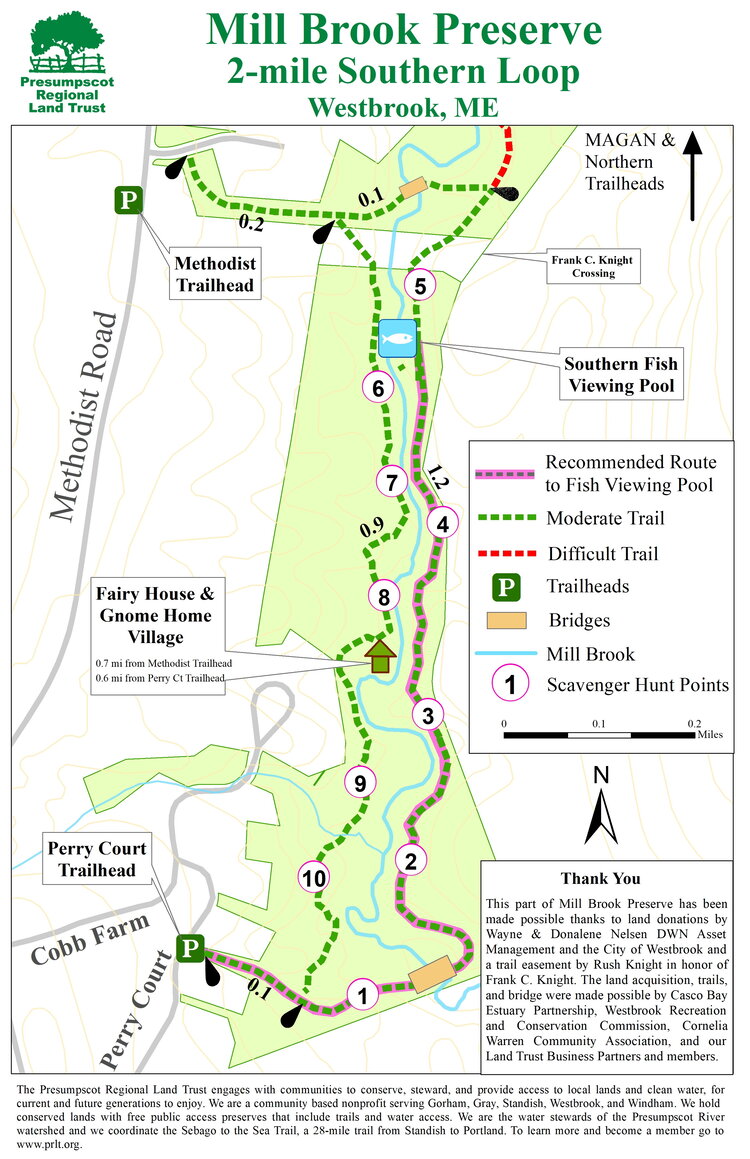
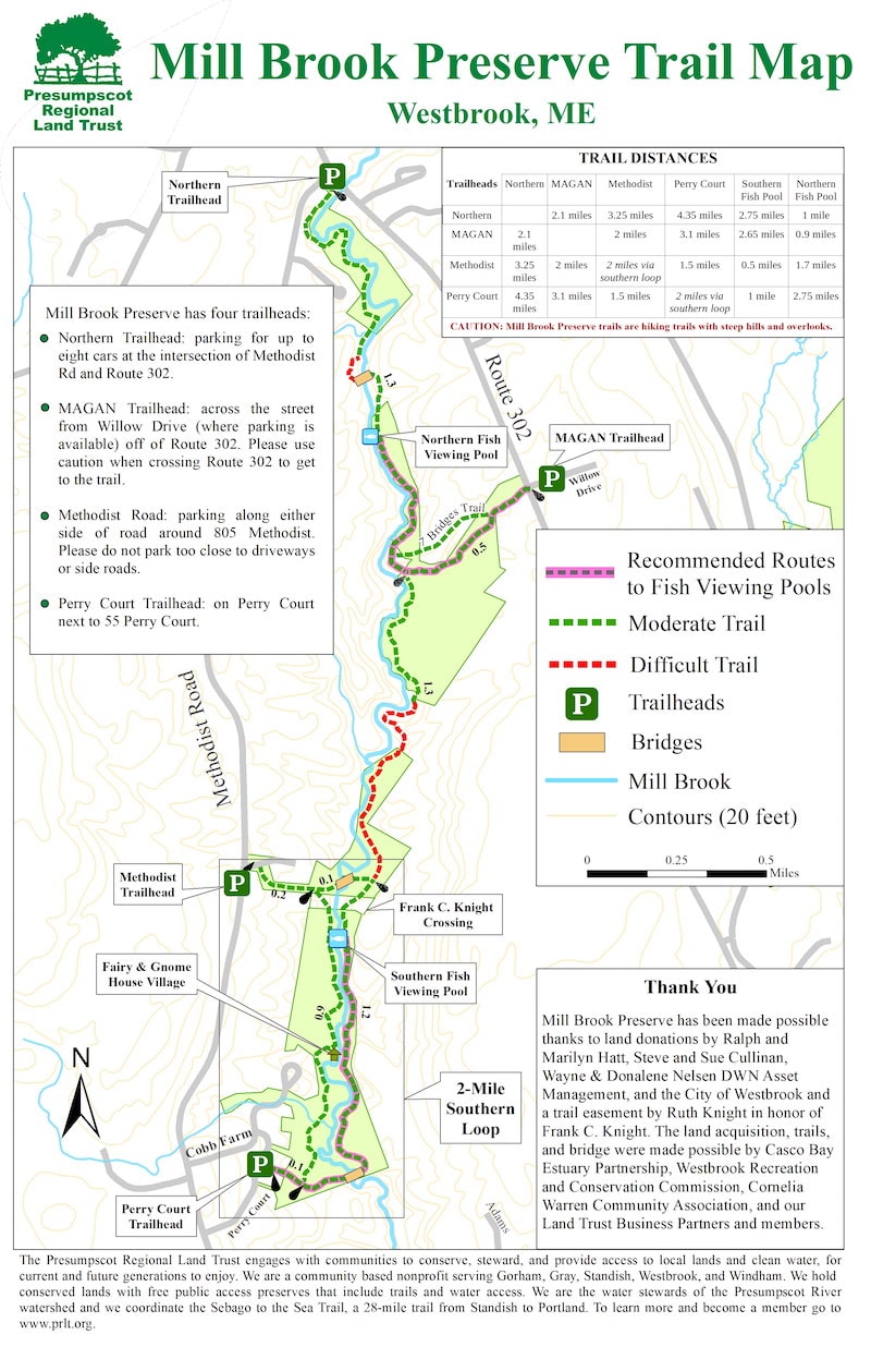
This trail includes six delightful miles along the Mill Brook — a mostly wide, shallow, and rock strewn little river. There are four trailheads with parking.
The riverside path does go up and down quite a bit, and there are a few scrambles up steep sections. In the spring—late May and early June—you can catch the spectacular sight of alewife fish migrating from Casco Bay to Highland Lake. The Presumpscot Regional Land Trust’s maps indicate the best places for fish viewing. (A few places also look like good swimming holes.)
If you prefer loop trails, you can make a 2.4-mile loop at the southern end of the preserve, which is also a recommended route for fish viewing pools. This area avoids the steepest parts of the trail system.
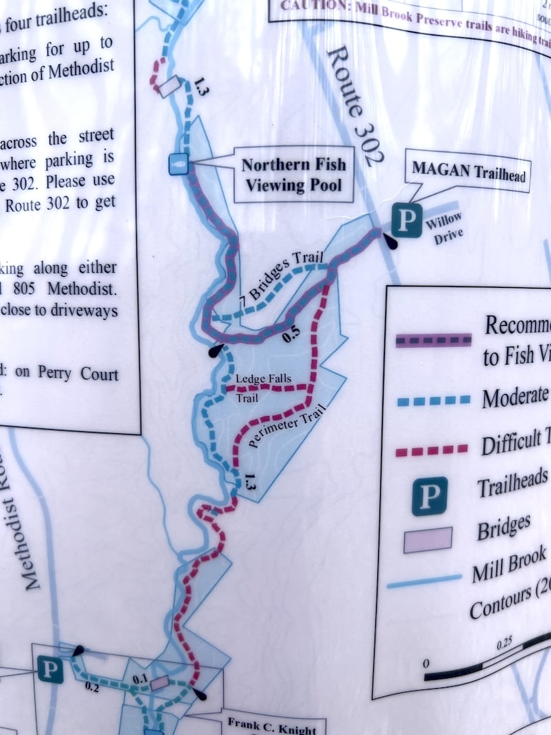
Additionally, close to the Willow Drive trailhead, you can do a few smaller loops (with a couple steep hills) that include cascading streams (it feels at time like you’re in a landscape of waterways that create a sonic wonder world!), charming landmark signs, and an overlook (mostly of power lines).
The land trust map marks the trails as moderate and difficult (as well as the route for prime alewife viewing in season). The difficult ones can be very steep! But you can plan your walk to mostly avoid these sections.
Directions: There are four places to start your walk and leave your car. One is on Methodist Road, across from 802 Methodist Rd. You walk down a bank along a mowed snowmobile trail. Follow this until you see a trail sign. You can also park on the side of Willow Drive and cross Route 302 to reach the trail. You can also start your walk from Perry Court road or from the Northern Trailhead, at the intersection of Methodist Road and Route 302.