QUICK TRAIL FACTS
- Preserve Size: 165 acres
- Trail Mileage: 4 miles in network
- Pets: yes
- Difficulty: easy
- Sights: St. George River, woods
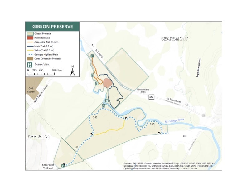
Gibson Preserve is a 165-acre parcel that contains two trail networks accessed at different trailheads. In total, there’s more than three miles of walking here. In the old days, it was once connected to a long-distance trail that linked the Gibson Preserve to Appleton Preserve, but I am not sure that trail is maintained any longer.
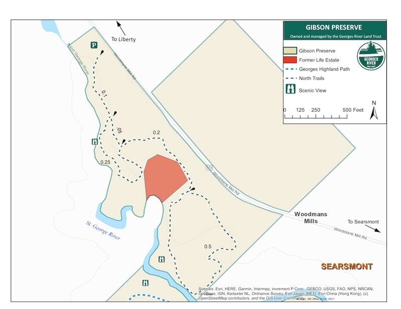
The northern trail segment includes a 0.4-mile wonderful wheelchair accessible trail that meanders along the river and makes a short loop. (I’ve marked it in yellow-green on my map.) You can head off the all-inclusive trail to do another 1.1-mile loop that will bring through a forest and to a spur to “the pool” where the river bends and deepens.
The southern section of the preserve a little harder to access (the road is rougher). It takes you into some cool, dark woods, and includes two small loops. The river views are slightly less impressive than from the northern side.
Directions: The north side of the property can be accessed from a parking lot off Route 173 (Woodmans Mill Road) in Searsmont. From the center of Searsmont (Fraternity Village Store), head west on Route 173. Travel 3 miles to the parking lot on the left (see map). The south side of the property is accessed from Ripley Corner Road in Searsmont. From the center of Searsmont (Fraternity Village Store), head west on Route 173 (Woodmans Mill Road). Travel 2 miles to Ripley Corner Road on the left (see map). Note, this road is not plowed in the winter. Parking is on the shoulder of Ripley Corner Road and visitors must walk in to the Gibson Preserve via an old woods road. Proceed down the road toward the river and cross the wood/concrete bridge. Take your first right onto the overgrown woods road and walk approximately ¼ mile to the Gibson Preserve entrance on the right. The kiosk is somewhat hidden off the road, so be on the lookout for a footpath that leads into the property and the kiosk. To your left at this point is the ridge-to-river trail.


