QUICK TRAIL FACTS
- Preserve Size: 700 acres
- Trail Mileage: ~10 miles in network
- Pets: yes
- Difficulty: moderate
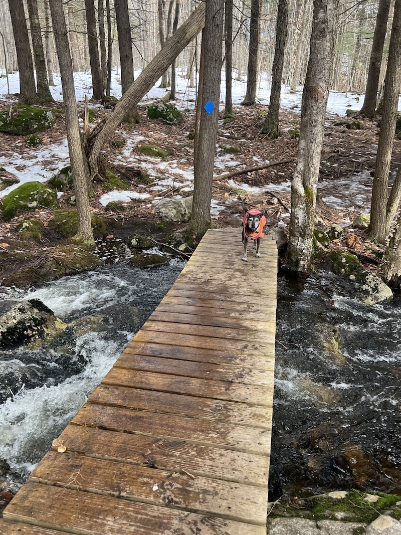
- Sights: Little Duck Pond, McIntosh Stream, scenic view
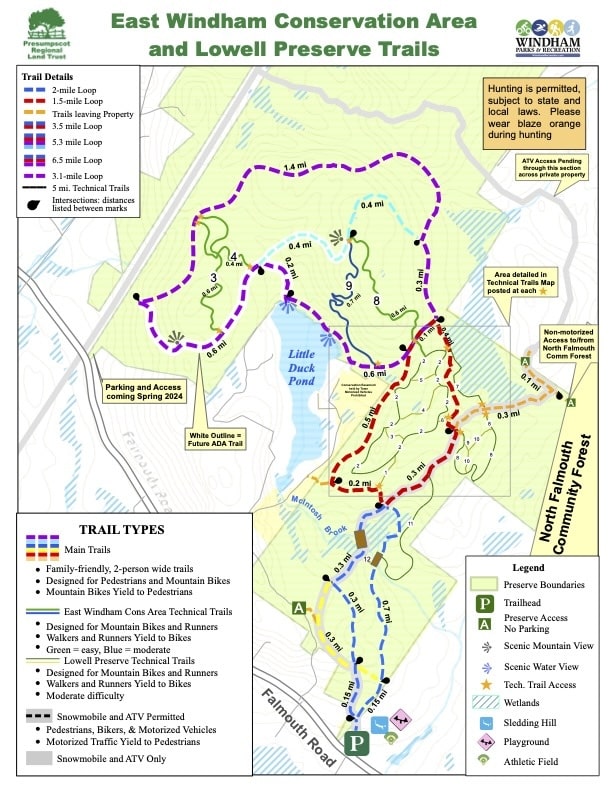
Trails in red are in Lowell Preserve and the East Windham Conservation Area. Blue trails are in North Falmouth Community Forest. The trails in Cumberland, Falmouth, and Windham are very well connected, either by footpath or snowmobile trail. Here is my attempt at a map that roughly shows the multi-town interconnected trail system.
The former Lowell Preserve has been incorporated into the 700-acre East Windham Conservation Area.
On this 700-acres conservation area in East Windham, you can hike, run, bike, or snowshoe for many miles. The Presumpscot Regional Land Trust has improved and blazed about ten miles of trails that connect to the many miles of trails in Falmouth and Cumberland, as well as to snowmobile trails.
From the large parking area behind the Windham fire station, you start off right away heading uphill. The paths are well-marked, and are categorized as either a main trail—which are wider—or a technical trail, which are designed with mountain bikers and runners in mind, but are pleasant to walk as well. At almost every intersection, the land trust has helpfully posted a trail map.
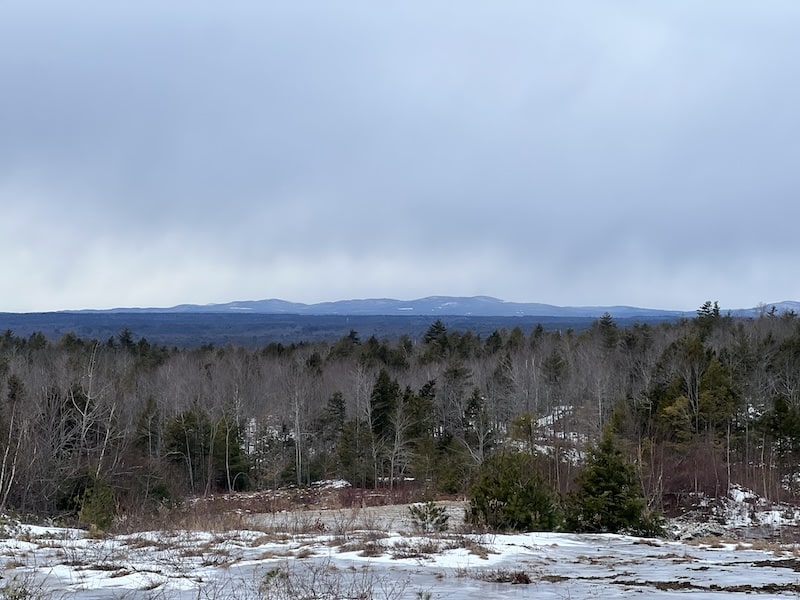
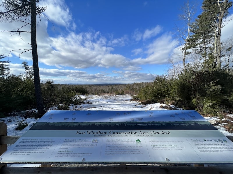
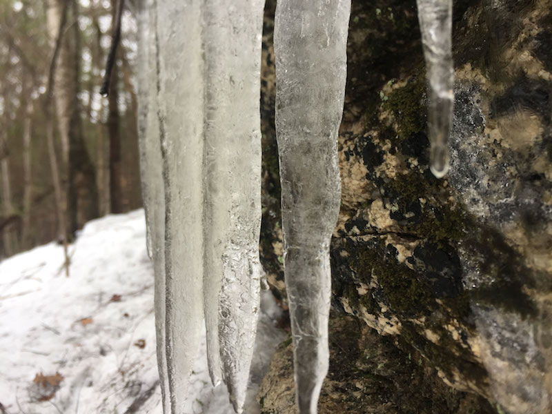
The highlights of this preserve are the scenic vista and the lakeside spot on Little Duck Pond, which looks like it could be a good swimming hole come summer! There are just a handful of cottages on the pond. At the vista, you can relax on two benches or check out the wide panel identifying visible Maine and New Hampshire mountains in the far distance.
Many visitors are likely interested in hiking up to the vista, a roughly 4.5-mile roundtrip from the Windham Fire Station, depending on your route. While you are gaining some elevation (~300 feet), it is a very gentle, easy hike. There are several ways up. From the Fire Station, perhaps the most direct route is to stick to the main trails — blue to red — and then catch #8 (an easy uphill). You can return the same way, or take #9 down, this latter path passes over some ledge.
If you want to stick to the main trails, follow blue to red to purple to light blue. The ascent up the light blue trail is not very steep at all. The ascent to the vista from the opposite direction, the west side, is a touch steeper. (Alternatively, from the fire station, you could follow the blue trail to the red trail and then zigzag your way up the technical trails (#1 to #2) and then take #8 to the top.)
The two main loops—blazed red and blue—form a figure eight loop that’s about 3.5 miles long. If you add on the 3.1-mile purple trail, you’re looking at a 6.5-mile loop. (The long purple loop, much of it gently rolling through harvested forestland, feels light and airy. Passages of it incorporate a wide gravel road.)
This spring, the land trust plans to build a second parking lot closer to the swimming hole and scenic vista, as well as an accessible trail.
If you’re looking for the connector to North Falmouth Community Forest, you’ll find the intersection halfway up the eastern side of the red trail.
Directions: The parking lot is at the East Windham Fire Station, 45 Falmouth Road, across from Beach Road and about 1,100 feet from Little Duck Road. You’ll see the trailhead in the field behind the station, and there is ample parking.