QUICK TRAIL FACTS
- Preserve Size: 2,064 acres
- Trail Mileage: ~10.3 miles in network
- Pets: yes
- Difficulty: moderate
- Sights: views, ledges, open summit (2,006 ft.)
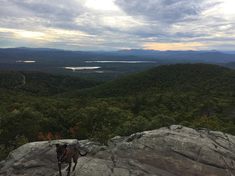
I think this might be Maine’s most popular mountain, this one or Tumbledown. The 2,006-foot Pleasant Mountain (the highest peak in southern Maine) is just an hour drive from Portland, and it has beautiful views, so it’s common to encounter many hikers at the summit on a nice day. That being said, there are several routes up and down this mountain — some, I believe, more popular than others.
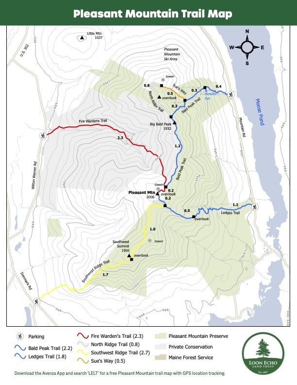
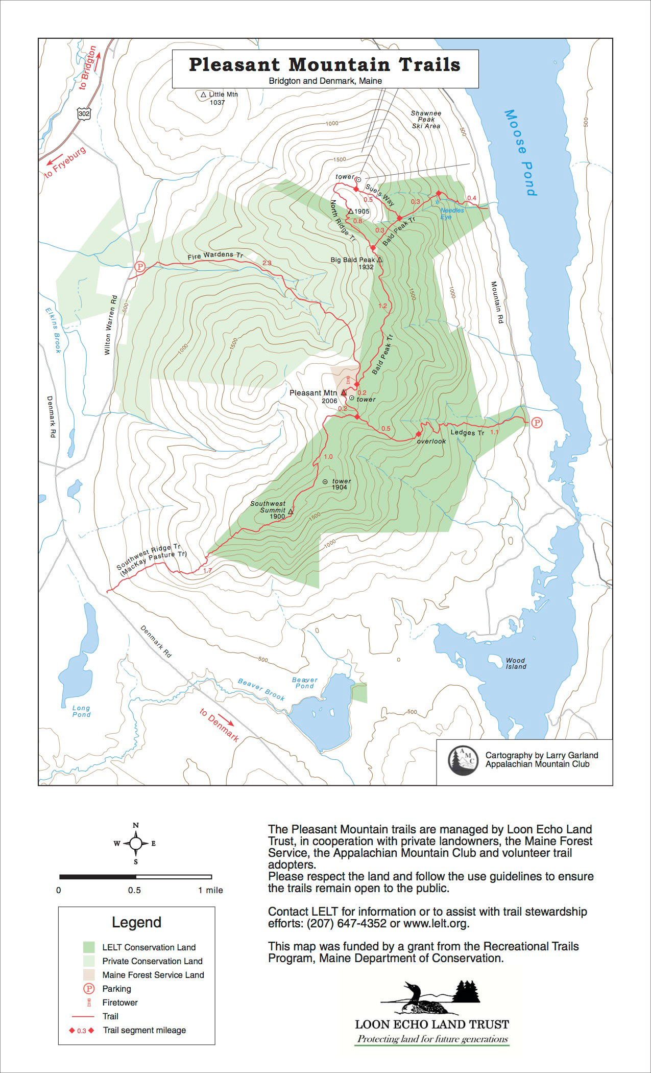
Loon Echo Land Trust has done a great job with this ~10.3-mile trail system. Their map has good info about trail distances and elevation gain.
The classic way up Pleasant Mountain is the 1.3-mile Ledges Trail, a short, somewhat steep and glorious trail to the main summit and old fire tower, with ledges and views along the way. I always find most hikers on this path. I believe a slightly less popular trail is the 2.9-mile Southwest Ridge Trail, which in my mind is just as beautiful as the Ledges Trail, a bit less steep and a little longer.
Over on the north side of the mountain, you have the option of hiking up the rather steep 1-mile Bald Peak Trail, and across the gentle 1.2-mile ridge to the main summit. There are stunning views — and picnic tables — at the ski lift and tower, which you can reach if you head off on Sue’s Way Trail from the Bald Peak Trail. I recommend doing this. (By the way, The Needle’s Eye, off of the Bald Peak Trail, is a rock formation that might have water coursing through it when we’re not in the middle of a drought! It’s accessed by a spur off the main trail.)
The Fire Warden’s trail, while nice, is the least exciting way to get up the mountain. If you are able to do a traverse, I recommend going up Bald Peak Trail and over to the main summit, and then taking Southwest Ridge Trail down.
Directions: From Portland, follow Rte. 302 west to Bridgton and continue on Rte. 302 for roughly 5 miles. Turn left onto Mountain Rd. and drive past Shawnee Peak Ski Area. The parking area for Bald Peak Trail is 1 mile down on the right. The Ledges Trail parking area (on the left, the trail is on the right) is 3 miles down.You’re not allowed to park on the side of Mountain Road if the lot is full. You can use the overflow parking area in the lower east-side lot at Shawnee Peak as a back-up.
The Fire Warden’s and Southwest Ridge Trails are on the west side of the mountain, located off of Wilton Warren Rd. and Denmark Rd. To find the Fire Warden’s trail, look for a big yellow mansion on Wilton Warren Rd. The trailhead is just next to it, through a closed gate. You’ll see a warn wooden sign for the trail, and the kiosk is up the trail a bit in the woods. The Southwest Ridge Trail is also not marked, but you’ll see a kiosk if you pull into the parking area.


