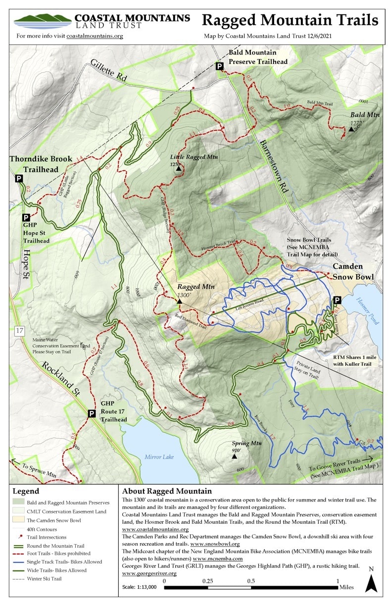
QUICK TRAIL FACTS
- Preserve Size: Not sure
- Trail Mileage: ~19 miles in network
- Pets: yes
- Difficulty: easy to moderate
- Sights: views, open summit (1,310 ft.)
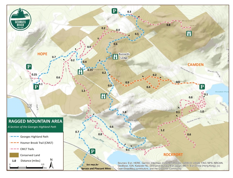
Ragged Mountain trails are blue (Round the Mountain Trail in darker blue). Spruce Mountain and Mt. Pleasant are green. Bald Mountain is orange.
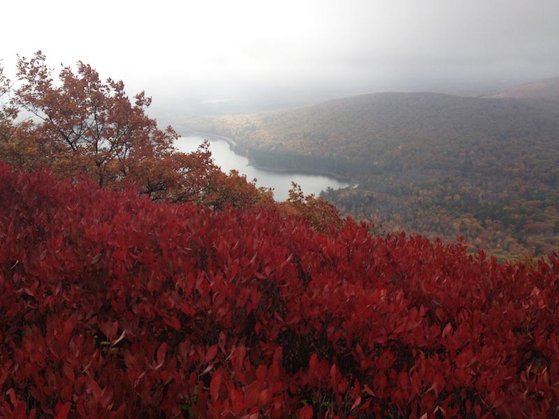
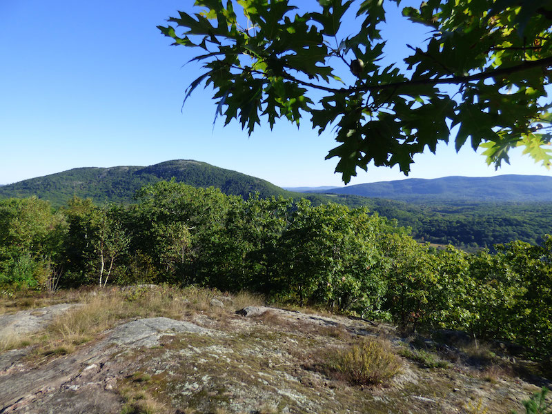
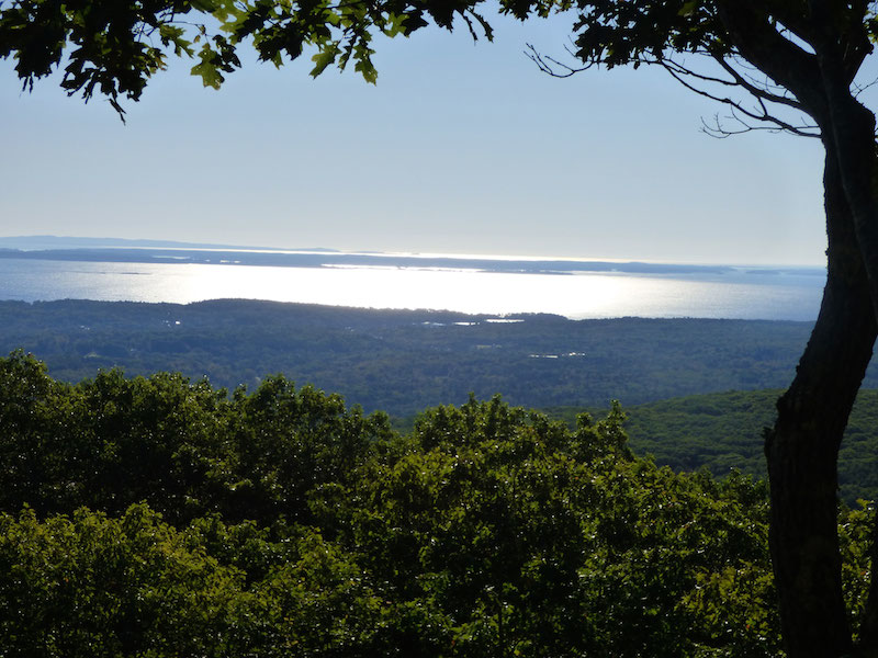
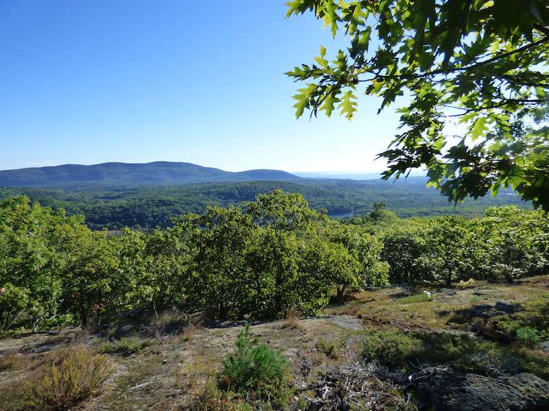
The small mountains behind Camden and Rockport are ideal hiking spots. They are small, so not intimidating, and offer much exposed ledge, making for breathtaking views — often as far as the sea and, on the other side, to Mt. Washington and the White Mountains. The mountains in Camden Hills State Park are very popular, but Ragged, Spruce and Bald mountains are almost as gorgeous and less visited, I believe. They are protected by Coastal Mountains Land Trust.
Ragged is a mountain of many trails! You have your choice on how to summit. Ragged Mountain’s trails connect to the trail systems of Spruce and Bald mountains, so you can go for a long traverse here.
The trails are well-marked and occasionally steep. To summit Ragged Mountain from Route 117, it’s a 2.5-mile hike, much of it on flat land as you walk toward the mountain. Then it’s not too difficult to get to the top, where there is a tower. The trail here veers away from the tower — it’s easy to get confused at this point. Continue on for another mile or so to another high, open point on Buzzard’s Ledge.
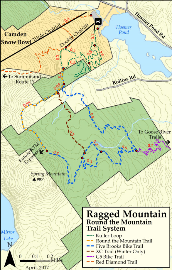
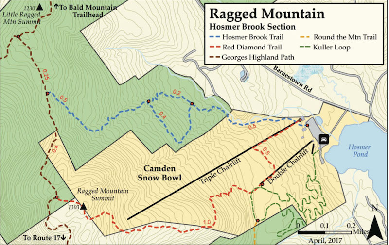
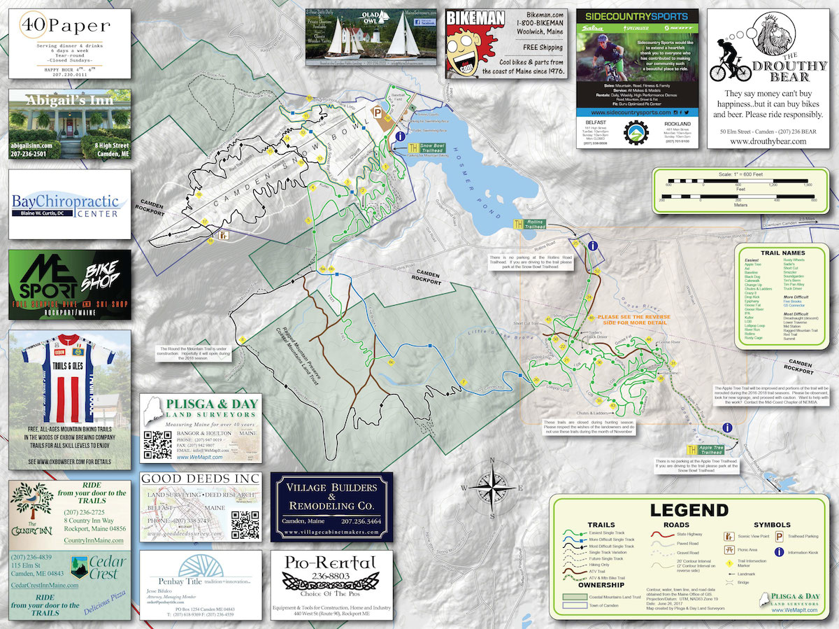
The paths on the Camden Snow Bowl are popular with mountain bikers. A very nice loop from the Snow Bowl is to head up the Hosmer Brook Trail, which, after you get off the mountain, is a footpath for hikers and snowshoers. To find the Hosmer Brook Trail, which is blue blazed, you’ll have to head to the far right of the mountain and start hiking up one of the downhill ski trails called Spinnaker. You’ll see the brook trail headed into the woods, on your right, at about .25 miles. It climbs for 1.2 miles (although you could just do a little loop in the woods and return for a 1.6-mile hike), before reaching the long-distance Georges Highland Path. If you take a left at this point, you’ll walk about .4 miles to the junction with the Snow Bowl’s red trail. Take this down, past the tower (I saw another trail with cairns here, but didn’t explore), and down the mountain. There are some lovely views along the way. It’s about 1.7 miles.
To do this in reverse, the best way to catch the red trail is to either follow the double chairlift up to where it ends at a patch of woods. You’ll see the blazed trail slightly to your right, if you’re looking up the mountain. Or you can start by climbing up the road underneath the triple chair, and at .3 miles, turn left onto a track to cross the ski slope to the double chairlift. Continue walking up, and you’ll see the well-blazed red trail just to the right at the end of the lift.
A 5.5-mile section of the Round the Mountain Trail, built in 2020-2022, takes you below the craggy ridge of Ragged Mountain and curves around the northeast side of Mirror Lake. While there are some rolling hills, you don’t summit any mountains on this trail; it’s fairly easy and has nice views (in the winter, through trees) despite not reaching higher elevations! It is also popular with fat bikers. I believe it is gravel-based, and there is a wheelchair accessible portion at the start, near the Thorndike Brook trailhead. Occasionally in good winter conditions, it is groomed, a local user told me. Additionally, is popular with Nordic skiers.
I have started exploring the eastern side of this trail system, gradually getting closer to NEMBA’s Goose River trail network, which is a system designed for mountain bikers (these are not shown on my Google map). The Ragged Mountain side trails, as I’m calling them, start from the bunny slope on the Snow Bowl, branching off left about half-way up, and then criss-crossing uphill. You’ll see a trail kiosk in front of and slightly to the left of the bunny slop where you can park. You can also park in front of the tennis courts nearby.
These particular side trails aren’t blazed, as far as I could see, but they’re wide and easy to follow. The main trail is culled Kuller. It will take you to the Coastal Mountains Land Trust’s blazed Round the Mountain Trail loop (which is wide and easy) and blazed 5 Brooks Trail, which connects to the Goose River trail system. I’ve included some maps and links to help newcomers find their way around this sprawling system.
Directions to the trailheads: You can plug in Camden Snow Bowl into your GPS — it’ll get you there! The ski area is on your left if you are driving away from Camden on Hosmer Pond Road. There are at least three other trailheads that hikers can use to access Ragged Mountain: Barnestown Road (north), Hope Street (west), and Route 17 (south). The Barnestown Road trailhead also serves the Bald Mountain Trail. The parking lot here is 1,000 feet south of the intersection of Barnestown and Gillette Roads in Camden. The western trailhead, also known as the Thorndike Brook Trail, is on Hope Street in West Rockport. From the intersection of Routes 17 and 90 in West Rockport, travel 2.5 miles north on Route 17 and turn right onto Hope Street. Travel 0.5 miles to the parking lot on the right. The Route 17 trailhead also serves the Spruce Mountain and Mount Pleasant trails to the west of Ragged Mountain. The parking lot here is 2 miles north of the intersection of Routes 17 and 90 in West Rockport.