QUICK TRAIL FACTS
- Preserve Size: NA
- Trail Mileage: 5 miles one way
- Pets: yes
- Difficulty: easy, with some steep sections
- Sights: Georges River
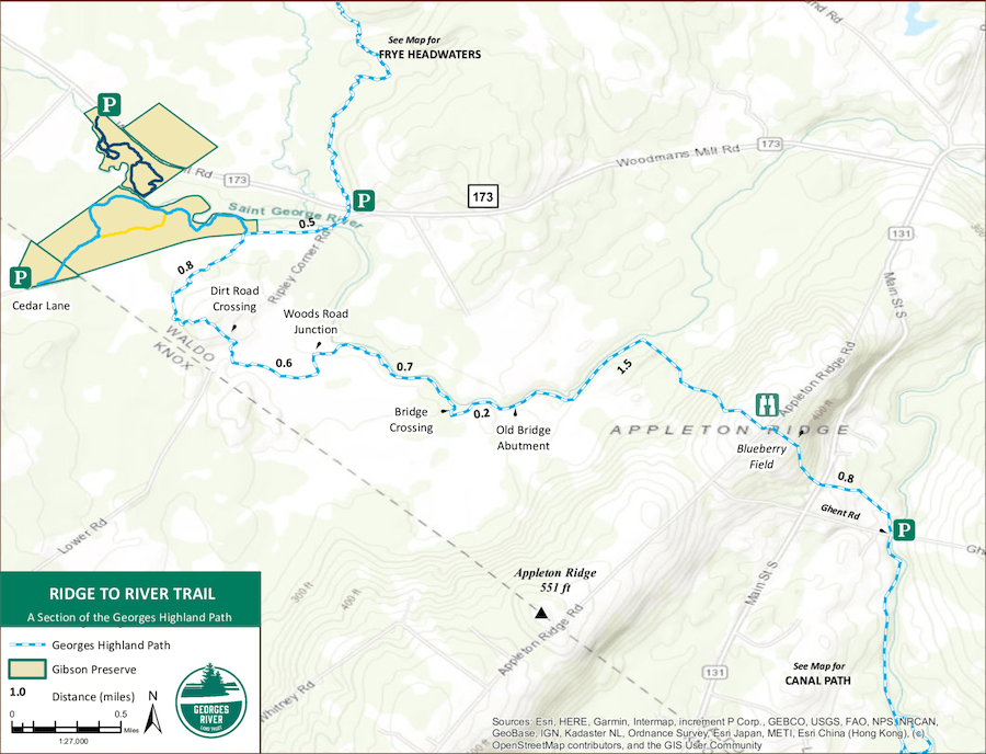
In my map above, I’ve marked the four trail segments of the Gibson Preserve-to-Appleton Preserve trail with different colors. The Ridge to River segment is blue.
Note: I am not sure how much this trail is being maintained these days.
If you set off from Gibson Preserve, you can hike along the Georges River for about four miles to connect to the Canal Path and finally, finish at Appleton Preserve. The 5-mile Ridge-to-River trail is at its best as you walk along the Georges River. Beautiful. At one point, it appears you are at a dead end when the trail (coming from Gibson Preserve) butts up against a wide brook. Don’t fear! Look for the blue blazes to your right, the trail makes a wide detour around this wet area. The path eventually deposits you on the open and high Appleton Ridge, at the Appleton Ridge Road, which you cross. You cross one more road, Rt. 131. From the road, head directly down the middle of a tree farm to find the path at the other end.
Directions: The west trailhead is the southerly entrance to the Gibson Preserve in Searsmont. From the center of Searsmont (Fraternity Village Store), head west on Route 173 (Woodmans Mill Road). Travel 3.1 miles to West Appleton Road and turn left. Continue for 1.1 miles and turn left onto Cedar Lane. Park at the end of the road and walk to the kiosk at the beginning of the trail.The east trailhead is located at Robbins Lumber in Searsmont. From the Fraternity Village Store in Searsmont, at the intersection of Routes 131 and 173, head south on 131 for 1.7 miles to Ghent Road on the left. Travel 0.25 miles on Ghent Road to the parking area on the right, just after crossing the bridge.

