QUICK TRAIL FACTS
- Preserve Size: 304 acres
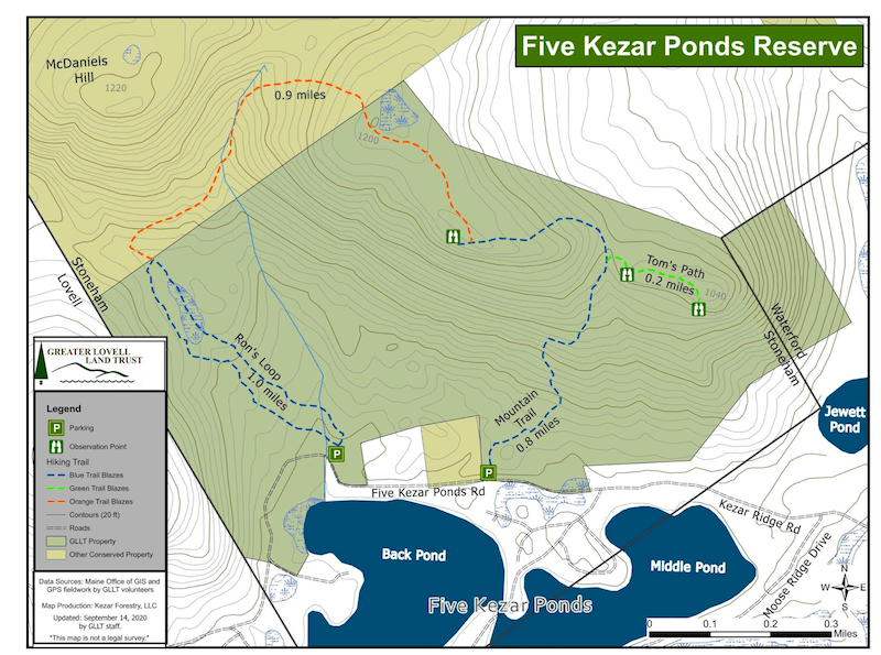
- Trail Mileage: ~3 miles in network
- Pets: yes
- Difficulty: moderate
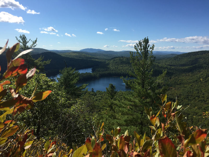
- Sights: views, open ledge (~1,120 ft.)
This is a marvelous hike (once formerly known as Back Pond Preserve). Perhaps most people will have an easier time finding it than I did, but once you do finally come upon the trailhead, which feels hidden in a warren of dirt roads, you will have a lovely hike! And once you are on the trail, you will definitely not get lost, thanks to the very attentive care of those who blazed and marked this trail. The views from the open ledge at the summit, more than 1,120 ft., are great. The Greater Lovell Land Trust protects this land.
The hike is short, but relatively steep. It’s about 1 mile to the summit from the eastern trailhead on Mountain Trail— following a blue-blazes trail, and another 1.5 miles back down to the western trailhead, following an orange-blazed trail. (Ron’s Loop is .85 miles.)
Directions: If you are coming from the north, from Route 35 and North Waterford, take 5 Kezar Road. A bit short of two miles on this road, take a right onto Kezars Ridge Road. Follow this for .65 miles and bear right at the fork onto 5 Kezar Ponds Road. The first trailhead will be on your right in a little under 1,000 feet.
If you’re coming from the south, from Route 5, take a right on Old Waterford Road, about .6 miles from the intersection of Routes 5 and 93. Follow Old Waterford Road for about 3.3 miles, until you take a left onto 5 Kezars Road. Go about 2.5 miles, look for Kezars Ridge Road on your left. Follow this for .65 miles and bear right at the fork onto 5 Kezar Ponds Road. The first trailhead will be on your right in a little under 1,000 feet.
<p> </p>