QUICK TRAIL FACTS
- Preserve Size: N/A
- Trail Mileage: 1.6 miles to summit from Heald Pond Road
- Pets: yes
- Difficulty: challenging
- Sights: gorgeous views from 2,948-ft summit
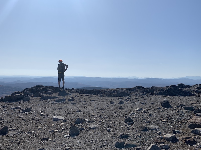
I found this 2,948-foot mountain to be oddly futuristic. But also beautiful, with stunning views! And the one trail we took to the summit, albeit steep (you gain 1,469 feet in elevation), is fun and well marked. (There are two trails that summit this mountain—we only had time to do one of them, but I’ve marked in orange on my map where I believe the second trail goes. I hope to return soon to complete my map.)
Why is this mountain futuristic? It has fairly wide expanses of arid, rocky areas that look a bit like they could be the surface of the moon. Also, at the top, like many other mountains, there is a radio tower powered with solar panels and a helipad. So that’s a bit futuristic.
While this mountain is wonderful, the drive out to the trailhead off Heald Pond Road is long, rough and rocky. Best to have a high-clearance vehicle. There is another western trailhead closer to Route 201, near Deer Bog. Like I said above, I didn’t have time to explore this trail, but I marked with a green icon Deer Bog, and also traced where I think the trail might go down the ridgeline of the mountain.
The southern trail that we did hike, which departs from Heald Pond Road, is very well marked with cairns, signs, and plastic blue tags. It starts off on an overgrown logging road before taking a sharp right (marked with a cairn and an arrow) into a low spruce forest interspersed with sections of loose rock. This trail goes steeply uphill. At about 1.2 miles, you see a side spur leading to an outlook. Shortly after that, you’ll reach the intersection with the West Trail heading down to Deer Bog. Go right at this point to reach the summit in .4 miles.
But don’t miss the fantastic western ledges. You reach them by taking the West Trail about .2 miles. Look for a sign to the lookout on your left. If you start descending down into a forest, you’ve gone too far.
Directions: You really need a high-clearance car to drive these long dirt logging roads. From Route 201 in Bingham, turn east onto Route 16. In about 5.5. miles, turn left onto the gravel Townline Road (for some reason this road is not named on Google Maps). Stay straight when it intersects with Dead Water Road. Follow Dead Water Road for about 2.2 miles, and then take a left onto Heald Pond Road. You’ll follow this approximately 4.5 miles to the trail head, which is marked with a sign on your right. Park off the side of the road. It’s helpful to download a map on your phone that shows these dirt roads before you leave for your hike. Additionally, there is a second trailhead near Deer Bog. I’ve marked the bog with a green pin on my map but I haven’t explored that trail yet.


