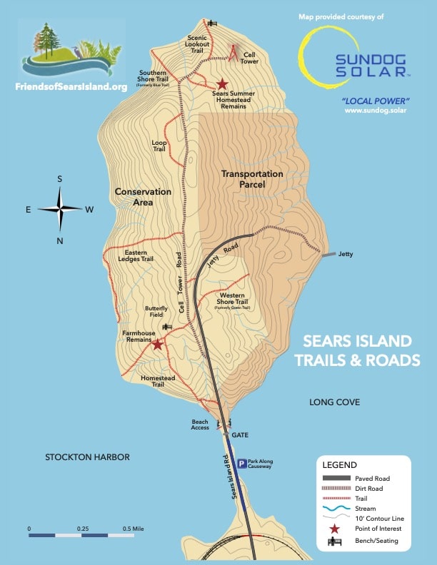
QUICK TRAIL FACTS
- Preserve Size: 940 acres
- Trail Mileage: ~5 miles in network
- Pets: yes
- Difficulty: easy
- Sights: views of the bay
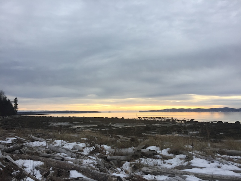
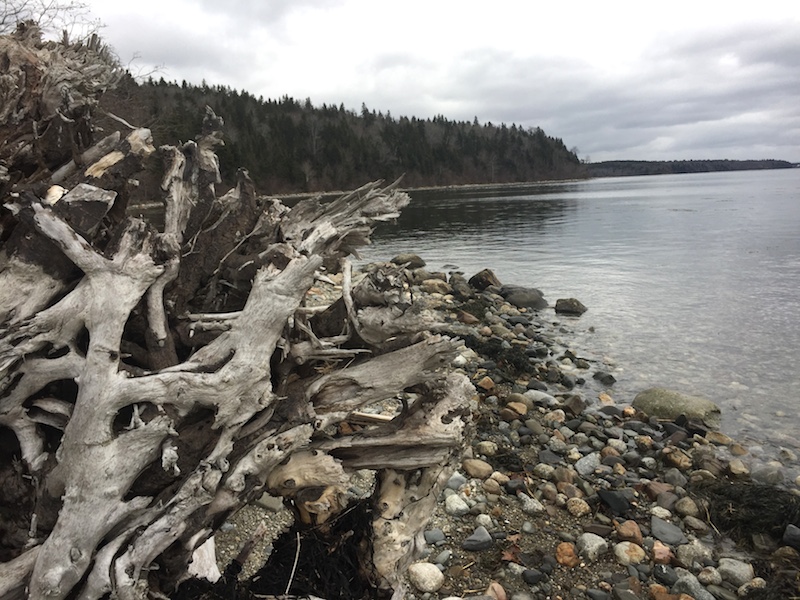
If you have the time, you should walk all the way out to the end of this two-mile-long island. It is so peaceful sitting on a sea-worn log, listening to the water lap at the stony shore. I saw lots of people walking along the beaches, presumably heading out to walk the five-mile island perimeter. The beaches seem to be mostly rocky and pebbly, and sometimes they disappear in high tide, but this is a really nice way to explore the island.
There are a few footpaths and two old roads on the island. While I found the short footpaths delightful, the roads — which are straight and long — are not that fun to walk along.
The tower is just a radio tower. The highlight of the island in my view is the quiet beach at the end of the Blue Trail, at the tippy point of the island, roughly 2.2 miles from the parking lot. The conserved island is cared for by Friends of Sears Island, which says it would like to design new low-impact trails sometime in the future.
Directions: After passing through downtown Searsport (if you’re coming from the south, continue on Route 1 for two miles until you turn right onto Sears Island Road. Drive all the way to the end, where you can park by the gate.