QUICK TRAIL FACTS
- Preserve Size: NA
- Trail Mileage: ~.7 miles one way (the stretch in my map)
- Pets: yes
- Difficulty: easy
- Sights: woods
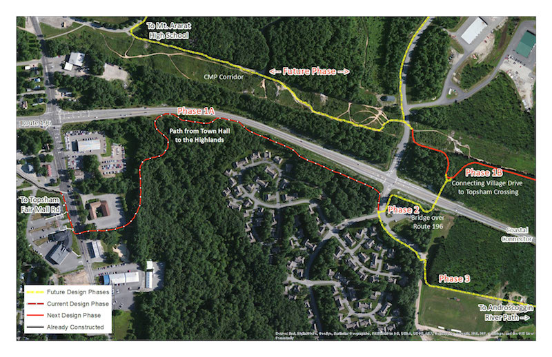
This is the first leg of a paved Topsham Bike Path. You’ll see a map below showing the stages still to come. If you park at the municipal buildings, you’ll cross Main Street and start off on a short section in the woods. The rest runs along the busy Brunswick/Topsham Bypass. Eventually the path will connect with the Androscoggin River Path. The whole length of the trail is paved and wheelchair accessible.
Directions: Right now the best place to pick up the trail is at the Topsham town hall on Main Street. Cross the street and head down the path.