QUICK TRAIL FACTS
- Preserve Size: 209,644 acres
- Trail Mileage: 5.3 miles one way
- Pets: no
- Difficulty: easy
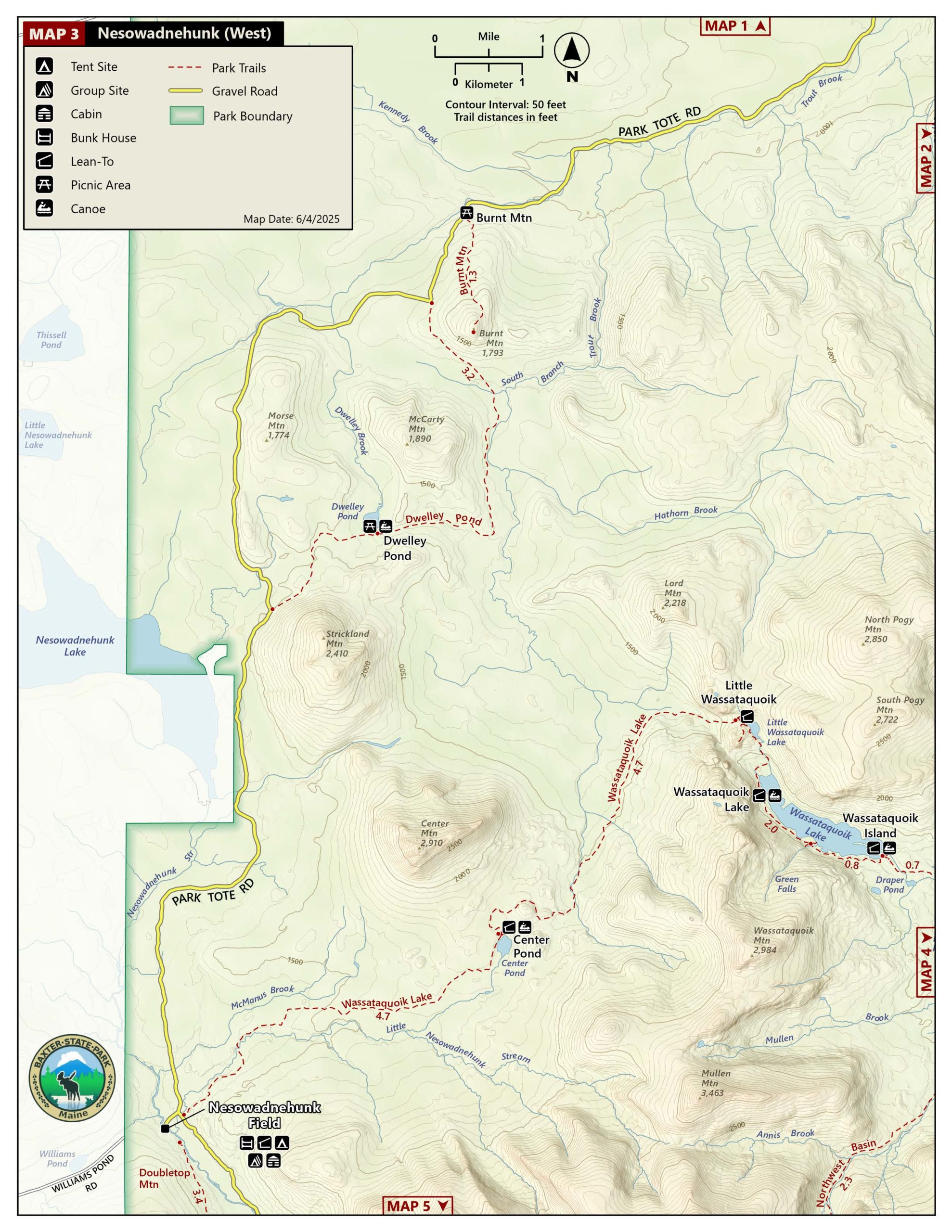
- Sights: Dwelley Pond, small meadows
When we were in this part of the park, we heard from several people that Dwelley Pond was a good place for moose spotting. We didn’t see any, sadly, when we hiked this one-way, 5.3-mile trail. But there is a little side trail to the pond’s edge, where you can launch a canoe. You can arrange to rent one from a park ranger.
There are two parking areas off the Tote Road for this walk. From one trailhead, it’s about 1.6 miles to Dwelley Pond; from the other, it’s roughly 3.8 miles.
The walking is flat and easy, as it follows an old road, especially the more traveled 1.6 mile section to Dwelley Pond. Beyond that point, the trail is wet in sections, as well as overgrown in a few spots. I enjoyed walking through a small meadow, about 2.5 miles or so beyond the pond, where there are a few benches set up for bird watching.
The park provides good online maps of its different regions.
Directions: The trailhead is 5.7 miles north from Nesowadnehunk Campground via the Park Tote Road. The second trailhead is another 4.8 miles farther along the road.


