QUICK TRAIL FACTS
- Preserve Size: 250 acres
- Trail Mileage: 2.3 miles
- Pets: yes
- Difficulty: easy
- Sights: 1950s stone bridge, meadows, wetlands
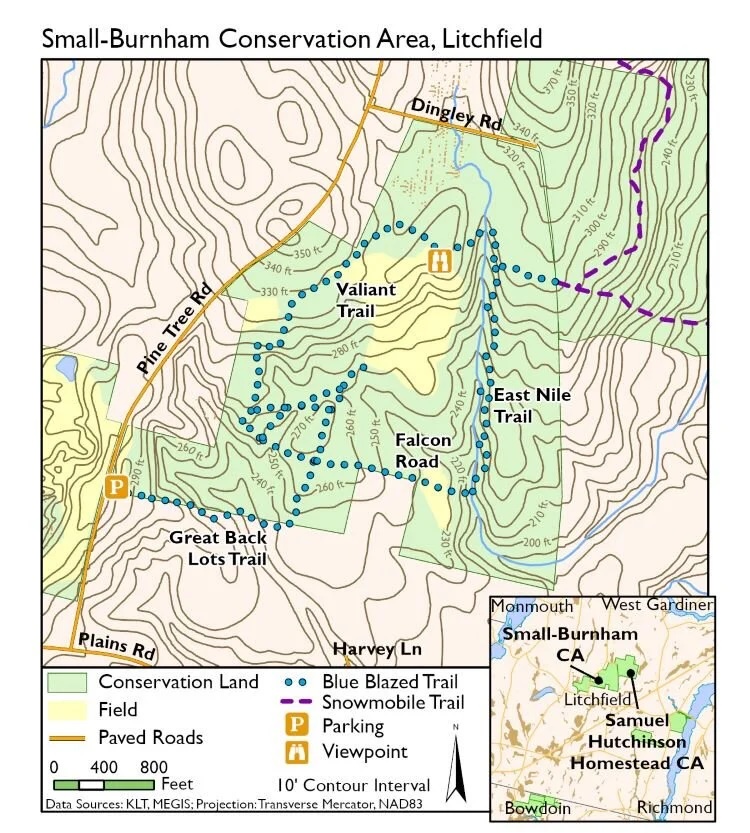
The 250 acres at this Kennebec Land Trust property includes two meadows, one large and one small, and two pretty trails through forest that follow high banks above streams (the East Nile Trail and the Great Back Lots Trail). The trails are well marked. A snowmobile connects this land preserve with the abutting Samuel Hutchinson Homestead Conservation Area, across a dirt road, if you would like to hike or ski more, but these trails are less well developed.
The access trail to the loop is roughly 0.4 miles, and the loop itself is about 1.5 miles, according to my GPS. You can also walk into the center of the loop to reach a beautiful field.
On your walk, the land trust says keep your eyes out for a black locust stand, a small stone and concrete bridge from the 1950s, and a glacial marine clay bank that provided clay for pottery. So far I have only found the 1950s bridge! (Helpfully marked on a land trust map.)
Directions: From Monmouth, take South Monmouth Road to Days Corner, cross Route 126, and go over Oak Hill. Cross the bridge, and at the stop sign, turn left. Almost immediately take the first right onto Libby Road. At the stop sign, go straight onto Plains Road. Go for one mile to Pine Tree Road. Take a left. After 0.5 mile you’ll see the KLT sign and parking area on the right. There’s a small parking lot for a few cars and also plenty of room along the roadside.




Hiked here today with a friend. A great walk! Thank you so much for your blog. I never knew about several of these hikes that are a few minutes from home!
I’m glad you had a good walk! Thank you for your note.